spacing hack
I have a feeling that learning OpenLayers is now going to be moved to the back of the todo list in favor of tackling things that I can actually make decent progress on.
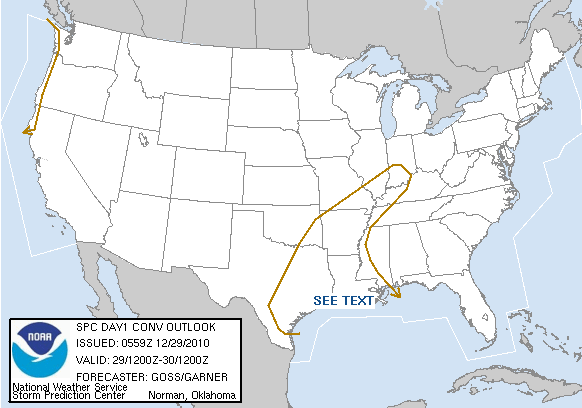
Like the wicked wx beta now supports the "TSTM" line on the maps. Previously I had just chucked those lat/lon points completely, in part because of the fact that I had no idea what they meant and also because they were full of these invalid "99999999" points which, when translated to proper latitude and longitude coordinates end up somewhere millions of miles north of Antarctica.
I now have a loose understanding of what the TSTM line is. It's the thunderstorm threat to the right of the line. But there are 2 problems:
And of course this is somewhat indicative of the problem I have with the Storm Prediction Center stuff in general. It's a wealth of good information, but it's obviously directed at other forecasters and not the general public.
And that's the gap I'm hoping to bridge with the site: take the SPC's great data and put it into an easy-to-understand format that anyone can use.
But first, I have to understand the data.